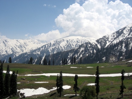
Gulmarg (translation: “Path of Roses“) is a town, a hill station and a notified area committee in Baramula district in the Indian state of Jammu and Kashmir.
Geography
Gulmarg is located 52 km from Srinagar. It has an average elevation of 2,690 m (8,825 ft).
Gulmarg is located 52 km from Srinagar. It has an average elevation of 2,690 m (8,825 ft).
History
Gulmarg has been a resort for the kings like Yousuf Shah Chak and Jahangir who used to visit frequently. The old name of Gulmarg was “Gaurimarg“, the name of Lord Shiva’s wife. Yousuf Shah Chak changed its name to Gulmarg, meaning the place of roses. During the early part of the 20th century the famous Central Asian explorer Sir Marc Aurel Stein(1862–1943), made his home here in a tent between his expeditions. It was a favourite summer holiday destination for the British stationed in India.
Gulmarg has been a resort for the kings like Yousuf Shah Chak and Jahangir who used to visit frequently. The old name of Gulmarg was “Gaurimarg“, the name of Lord Shiva’s wife. Yousuf Shah Chak changed its name to Gulmarg, meaning the place of roses. During the early part of the 20th century the famous Central Asian explorer Sir Marc Aurel Stein(1862–1943), made his home here in a tent between his expeditions. It was a favourite summer holiday destination for the British stationed in India.
The surrounding areas were politically restive during a period of relative peace and quiet. The town is nestled within the imposing Himalayan peaks, and lies within miles of the Line of Control. It receives heavy snowfall during the winter season and is a popular ski resort.
With the abatement of militancy in the area, Gulmarg has quickly become one of the state’s most visited destinations. The slopes of the Afarwat Hills of the Pir Panjal Range of the Himalaya Chain boast one of the longest and highest ski slopes in Asia. The total distance covered by ski lifts is five kilometres and the resort peaks at an altitude of 3,950 m (12,959 ft), accessed by an aerial gondola (telecabine).
The entire hill is guarded by the army at all times. The army, which is seen everywhere in the cities of Kashmir, is not in the town or the actual hilltop. Frisking is only done midway on the access road at 3 places: Tangmarg, near an army camp on the road from Tangmarg, and 5 km before entering Gulmarg.

No comments:
Post a Comment